Now, I know I've been boring lots of you with my minute by minute accounts ("and then I tied my laces again. I noticed that another thirty seconds had elapsed in doing this".., so I'll play this differently, it's photo time! Feedback to the usual unmonitored PO box... Also note that this was painful beyond compare to produce, so don't expect much more in this vein!!
Trek Summary including GPS References
Day 1
Bus from Huaraz, my base town here, to Chiquian. Collectivo from there to Pocpa. Could not believe they were planning to fit 25 people in this tiny minibus. They did.

25 into this goes how?
Ended up alighting before Pocpa at Llamac. Stayed overnight in a mud hut in Llamac, trying to sort out who would be our arriero.
Day 2
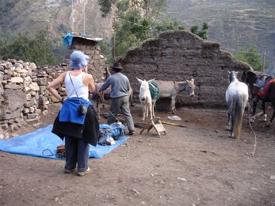
Loading up the donkeys..
Llamac to Laguna Jahuacocha [GPS: 10.23594S, 76.96562W] via the high route and Macrash Pass (4300m or 4272m depending on who you believe).

Three wise men? Err, not quite!
Later found out that high route was completely unnecessary, only donkeys have to go high.

Marvellous...

Clumps of cacti everywhere..
Good weather at Jahuacocha, fabulous as this is one of the highlights of the trip.
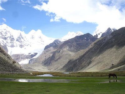
The view across the lake to Rondoy (5870m), Jirishanca (6094m) and Yerupaja (6617m)
Day 3

Suaraz waits patiently..
Laguna Jahuacocha to Matacancha / Quartelhuain [GPS: 10.15476S, 76.92322W] over the Rondoy Pass [GPS: 10.21717S, 76.93761W] at 4735m and the Sambuya Pass at 4750m.

Lovely colours in the lakes..

We have to go over that?!
Severe blizzard as crossing the passes.
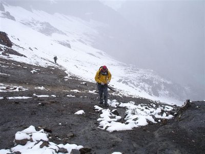
Head down..
Full cold gear engaged and sunglasses needed!

As required to go to work in London in February...
Overall miserable weather. If not snowing, it was raining (depending on how high we were).
Snow becomes...

Let's camp!
Day 4

Morning, cavallio!
Quarterhuain to Laguna Carhuacocha [GPS: 10.24102S, 76.86258W].
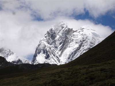
Good mountain action!
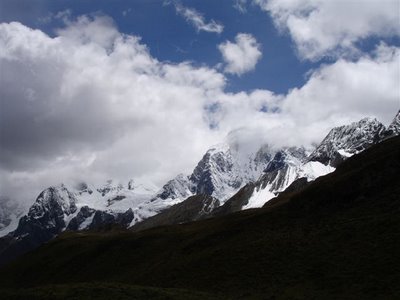
And then..
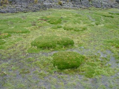
Toadstalls?
We skipped stopping at Laguna Mitococha (normal daybreak) as we had made good time to Janca village, so carried on over the Carhuac Pass at 4640m

The cavalry..
On to Laguna Carhuacocha, the next highlight of the trip (IMHO). Two days trek into one.
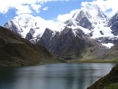
I've camped with worse views!

This fellow agreed..

Weary "I hate camping" in-tent shot!
Day 5

Waking up with a view.. and more importantly, some sun!
Laguna Cahuacocha to Huayhuash village (three houses) [GPS: 10.32794S, 76.84353W] over the Punta Carnicero at 4600m, which is the "easy" route.
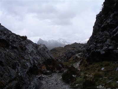
The rain is back..
I would not have liked to do the hard route (probably waste of time as only worth it when weather good).
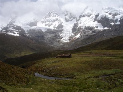
Pop round to the neighbours for some milk, won't you..?
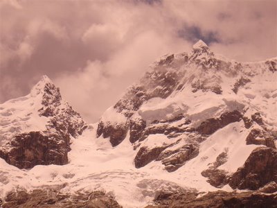
Sunglasses-tinted mountains
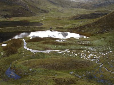
Looks pretty but it means wet and boggy paths, yucks
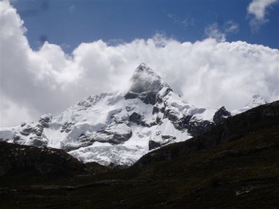
On a par with Machupuchre in Nepal?
At Huayhuash, at my suggestion, Suaraz, our donkeyman, asked around to find someone to cook for us. He found an 83-year old woman called Ignacia, living with her grandson, who cooked us a complete meal, including freshly caught fish from the river next to the house. Fantastic! 10 soles each for hot sweet potatoes, tasty mutton soup, then freshly fried fish with rice, and aniseed tea.
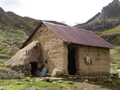
The place..
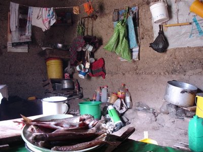
The inside..

Ignacia and her stove

Ignacia gets to work on the meat (sheep)
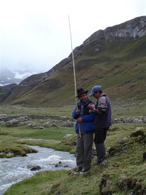
Meanwhile, we go find some fish in the river next to the house..
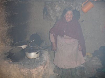
It's getting hot in here!
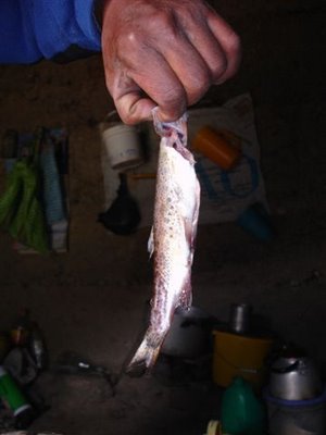
Some of these, Madam?

She knows just what to do with them :)

Finishing touches..

Delicious!

And squeeze some cheese for later.. Is asking for port too much?
Day 6

To the hills..
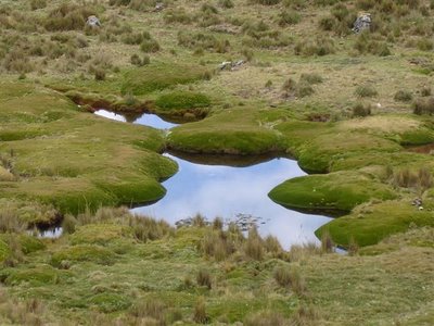
Water water everywhere
Huayhuash to Pumarinri Hot Springs [GPS: 10.41959S, 76.85774W] over our final high pass, the Portachuelo de Huayhuash [GPS: 10.37032S, 76.84508W] at 4750m and past Laguna Viconga, the largest lake on the circuit.

Water level down on former peaks (rainy season just starting), but still very pretty..
Was somewhat nervous around here, as this was where the four gringos were shot dead at the end of 2004 in a robbery. Hot springs were great! Had two dips in the afternoon. First was so hot as to be painful, but second was just perfect. Went to bed and didn't dream of having a nice soapy shower for the first time in several days!

The hot-tub!
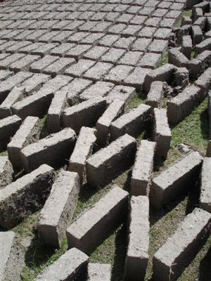
They're building a new bigger tub, very very slowly!
My take on the end scene of Apocalypse Now.. The horror!

The magic source of heat

And the black earthy areas that give away what's below..
Day 7
Survived the coldest night. At around 2am, suddenly my tent felt like it had been moved into a deep freezer. You know that freezing air that drifts out of your freezer when it's open? I could feel that coming from all directions! All clothes on and pull all the draw-strings on anything that can be pulled shut! A dip in the hot-spring in the morning was absolutely essential! From hot springs, we branched off from the circuit (avoiding the 5000m pass that would otherwise would have been next) and headed down to Cajatambo [GPS: 10.47209S, 76.99350W], a long but fairly flat trek.
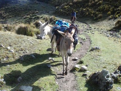
The donkeys follow..
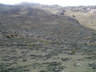
Silent sheep armies plan their descent to pillage the valley

The valley goes on, anon, anon..

Incas hadn't quite got the hang of tennis
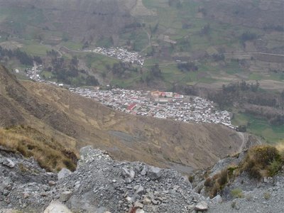
Cajatambo, our trek finish point, awaits below..

The final dinner for the happy group
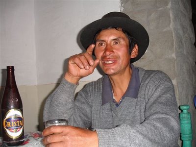
Suaraz recounts tales of his bull-fighting days after a couple of beers
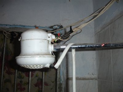
No way am I showering under that death-trap!
Day 8
Early-morning bus from Cajatambo at 6am to Lima.
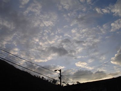
Up you come, sun!
What a bus journey! The first three hours are hair-raising as the bus whizzes back and forth along narrow mountain roads. What makes this worse than any other scary-mountain road is that it appeared to be entirely constructed of mud cut into the valley side. Landslides are extremely frequent, as is, I'd imagine, the whole road washing away, down the 1000m+ drops at the roadside (I exaggerate not). It's fairly usual to be held up a few hours or even days, whilst they recut the road, but in our case it took a mere 6 hours (!) to Patilvica, where we changed buses, i.e. stood at the side of the Panamerican Motorway, waving! [GPS: 10.68963S, 77.78515W].

Please someone stop!
Eventually took a bus that went close to Huaraz. Good enough! Arrived at about 5pm. 11 hours!
Observations
I was accompanied on the trek with a 21-year old Israeli girl. I had my doubts before setting off. They were confirmed. See below for full rant!
We travelled with an arriero (donkey driver) called Suaraz, two burros (donkeys). He rode a horse (cavallio). I asked him what the names of his animals were. He said the burros were called burros, and the cavallio, 'cavallio'. Enlightening :)
I carried my full pack, 'cos I'm 'ard. After the first day, Suaraz did insist on taking my tent off me to speed me up a little! In all honesty I found the first day the hardest day by quite a long way, so I didn't fight him too hard. Did carry rest of pack though, which was still heavy enough. Tent, by the way, being World's Lightest Tent (c), weighs 860g.
Rain became snow fairly consistently at about 44-4500m. When we encountered hail, it was heavy enough to hurt! The weather was definitely better than when I did Santa Cruz, and particularly fortuitous was that we had a few hours of good weather at the right points of the trek, i.e. Jahuacocha and Carhuacocha.
There were various spots on the circuit where it is common to spot condors. I don't think I saw any (one unconfirmed suspected sighting). Suaraz saw several, but always too late to point out to me!
Based on weather expectation, only took the Sony (P200) camera. Regretted it a couple of times when I had grand panoramas before me, but overall probably the sensible choice. Only complaint is that the slightest evidence of wet around and Sony sucks up the water on to its lens to make little blotches on the photo. Thanks, Sony!
Bought a kilo of fresh-from-press cow's cheese from Grandma Ignacia at Huayhuash, for 10 soles (£1.60). Absolutely delicious, despite the "unpasteurised milk" alarm bells ringing in my head, and it being covered in dirty fingerprints from when we purchased it. Don't seem to be suffering... yet..
There is no organised authority in charge of the Huayhuash area. I suspect this is because it falls between two administrative regions, the Lima region and the Ancash region. I guess it's the usual inactivity by committee situation. Anyway, the result of this is that every village and person charges you for being on "their" spot of land or area. The price each time wasn't much, 10 soles each, plus 2 for each donkey, but I think the whole area would benefit from a proper permit system, whereby the money is collected centrally and spent improving the local infrastructure, especially the state of the paths, which were pretty poor.
This time of year is low season, which was good in terms of the circuit being quiet (the only others we met were the four Americans, who were very nice chaps, and a small group of Israelis who were only doing a 4-day loop at the beginning). I would not like to trek in peak season, even if the weather were to be much better (suspect it would be like when Adrian and I ascended Poon Hill in Nepal, following the backside of the next person in line up to see the next view).
Water quality was variable. The first water I had was from Jahuacocha, and was so clean and free of sediment, one almost felt that iodine purification drops were unnecessary. As another arriero said, the quality was "olympico"! Other places, particularly where the rivers were fast-flowing, I would pour the water through my t-shirt in the hope of pulling some of the bits out, but still felt a bit queasy drinking it. The concern with sediment in the water is that the iodine sticks to the "bits" and fails to do its job in terms of killing nasties floating about. I seem to have made it out ok, but some of these things take a few weeks to bed in..! Watch this space!
Israeli notes (sorry, the venom is still present and needs to be sucked out of the wound!)
-> Was (is) a heavy smoker, with a nasty smokers' cough to boot. There is nothing worse to hear on a peaceful trek than a hacking cough in your ear. I would always drop back and walk well away from her! She also had a principle that she "never smoked on a trek", which she proudly broke for the first two days until she ran out of cigarettes. She then just talked about how much she was looking forward to a smoke for the rest of the trek.
-> Would complain about everything, and looks down on almost all aspects of local life. She would remark about how she thought that all schools were small and just consisted of one building, which was clearly rubbish - even on our first night we stayed next to a big school with playing fields and good-sized buildings, and that was in the tiny village of Llamac, with about 30 houses!
-> Would moan about prices of things all the time. When we had dinner with the 83-year old, she insisted to know the price beforehand. Who cares? These people are so poor, even if they charge us 10x what it's worth, it's still going to be nothing to us, and yet will mean so much to them. Several times I was quite embarrassed when she ask about prices at the most inappropriate times.
-> Was always suggesting she was so superior to other Israeli travellers, especially first-timers. Of course people who haven't gone trekking before won't know what to do. She also made a big thing about how she had a topological map and she'd never go trekking without one, yet every time she tried to read it, she'd get it completely wrong! There was a huge climb up to Cajatambo, our finish, apparently. I leant over and said "err, that's a descent". Oh yeah!
> But at least she did most of the cooking, even if she cooked enough for one person (for three of us). I didn't mind as I was dieting, but poor old Suaraz came away from every meal looking fairly hungry!!
My original plan was to trek this completely alone. Since she was coming, we had to get donkeys and a donkey-driver, and it was Suaraz who did add to the trek for me. I think it's a fair comment to say that even with language difficulties, having a local with you always adds to the experience. So for this reason, I suppose there was a benefit to having her about. Otherwise... ;)



1 comment:
Good old Duke of Edinburgh map-reading skills!
Post a Comment